

LAND DIVISION
LOCATION
Ne (GE)
TASKS
Topographical Survey, Cadastral Operations
STATUS
Completed
CUSTOMER
Private
DESCRIPTION
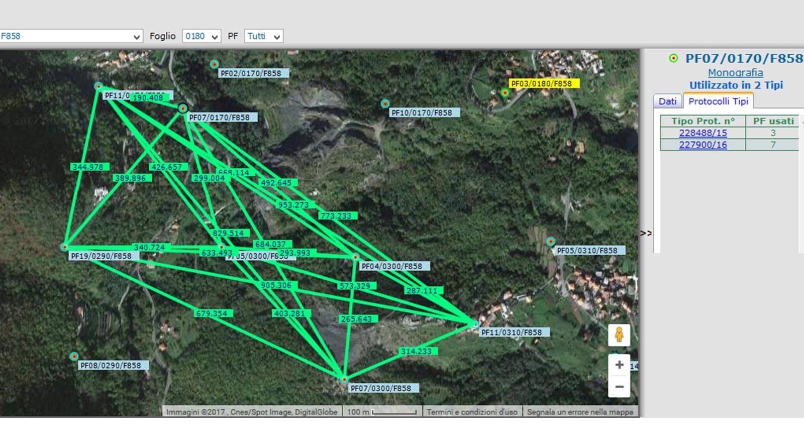
Carried out in a territorial area with a particularly challenging morphology and in a dense environment of vegetation, the Precision Topographical Survey carried out in order to divide up a piece of agricultural land in the Municipality of Ne (GE) involved 2 Municipal Hamlets and required the support of 7 Cartographic Reference Points scattered around the area concerned.
However, careful preliminary reconnaissance and a reasoned planning of the work allowed us to optimise the operating times and to carry out the task without any particular inconvenience.